Radar Meteorology: Unveiling Weather Patterns Through Advanced Technology and Scientific Innovation
Radar meteorology represents one of the most significant technological advancements in our quest to understand and predict weather patterns. By employing sophisticated electromagnetic systems to detect precipitation, measure wind velocities, and identify atmospheric structures, meteorological radars have revolutionised our ability to forecast severe weather and protect communities worldwide. This article explores the fascinating evolution of radar meteorology, from its wartime origins to cutting-edge developments that promise to further enhance our understanding of Earth’s complex atmosphere.
The Historical Evolution of Weather Radar Technology
From Military Applications to Weather Monitoring
The history of radar meteorology begins during World War II, when military operators of early radar systems observed an unexpected phenomenon: their screens displayed “noise” during rainfall, which they initially considered interference. This serendipitous discovery revealed radar’s potential for detecting precipitation, laying the groundwork for dedicated meteorological applications. By the late 1940s, military surplus radars were being repurposed for weather observation in the United Kingdom and United States, marking the birth of operational radar meteorology.
The 1950s witnessed the development of the first purpose-built weather radars, with the WSR-57 (Weather Surveillance Radar-1957) becoming the cornerstone of the United States Weather Bureau’s national radar network. These early systems utilised wavelengths of approximately 10 centimetres (S-band), allowing for detection of precipitation at considerable distances while minimising attenuation through heavy rainfall.
Technological Breakthroughs: Doppler and Dual-Polarisation
The 1970s brought a revolutionary advancement with the integration of Doppler technology into weather radars. Unlike conventional radars that merely detected the presence of precipitation, Doppler systems could measure the velocity of particles moving toward or away from the radar site. This capability enabled meteorologists to observe wind patterns within storms, identify rotation associated with tornadic activity, and better understand storm structure and evolution.
Professor Peter Meischner of the German Aerospace Center noted that “Doppler radar transformed our understanding of mesoscale meteorology by providing the first comprehensive observations of wind fields within severe storms.”
The subsequent breakthrough came with dual-polarisation radar technology in the late 1990s and early 2000s. By transmitting and receiving radar pulses in both horizontal and vertical planes, these advanced systems could determine the shape, size, and variety of hydrometeors (precipitation particles). This development significantly improved precipitation classification, distinguishing between rain, snow, hail, and mixed precipitation types with unprecedented accuracy.
The UK Met Office’s network underwent a comprehensive upgrade to dual-polarisation capability between 2010 and 2018, representing an investment of over £10 million that dramatically enhanced the nation’s weather monitoring capabilities.
Modern Radar Meteorology: Systems and Applications
Weather Radar Networks and Their Global Reach
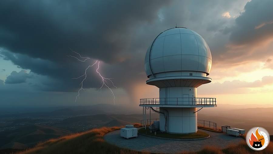
Today’s weather monitoring infrastructure relies on sophisticated networks of interconnected radar systems that provide near-continuous surveillance of the atmosphere. The United Kingdom’s network consists of 15 C-band Doppler radars strategically positioned throughout England, Wales, Scotland, and Northern Ireland, delivering composite imagery updated every five minutes.
Similarly, the European OPERA (Operational Programme for the Exchange of Weather Radar Information) project integrates radar data from over 30 countries, creating comprehensive precipitation maps spanning the continent. This collaborative approach exemplifies how modern radar networks transcend national boundaries to improve regional forecasting.
In the United States, the Next Generation Weather Radar (NEXRAD) programme, comprising 160 high-resolution S-band radars, forms the backbone of severe weather detection. This network, operational since the early 1990s and continuously upgraded, provides the data foundation for tornado warnings, flash flood alerts, and numerous other public safety applications.
Radar Data Processing and Integration
The true power of meteorological radar emerges through sophisticated data processing and integration with other observational systems. Modern radar products include:
- Reflectivity maps showing precipitation intensity and coverage
- Velocity fields revealing wind patterns and storm rotation
- Spectrum width data indicating turbulence intensity
- Hydrometeor classification identifying precipitation types
- Rainfall accumulation estimates for hydrological applications
These products undergo rigorous quality control to remove non-meteorological echoes such as ground clutter, biological targets (birds and insects), and anomalous propagation. Advanced algorithms then integrate radar observations with satellite imagery, surface measurements, and numerical weather prediction models to create comprehensive analyses of atmospheric conditions.
Dr Sarah Johnson, Principal Scientist at the European Centre for Medium-Range Weather Forecasts, explains: “The integration of high-resolution radar data with numerical models represents one of the most significant advancements in operational meteorology of the past decade, substantially improving forecast accuracy for high-impact weather events.”
Practical Applications Across Multiple Sectors
Radar meteorology extends far beyond traditional weather forecasting, providing critical information for numerous sectors:
Aviation Safety: Terminal Doppler Weather Radars (TDWR) at major airports detect wind shear and microbursts—localised, powerful downdrafts that pose severe hazards during takeoff and landing. Since their implementation, these systems have contributed to a significant reduction in wind shear-related aviation incidents.
Hydrological Management: Quantitative Precipitation Estimation (QPE) derived from radar observations enables more accurate flood forecasting and water resource management. Urban drainage systems and reservoir operations increasingly rely on radar-based rainfall monitoring for real-time decision-making.
Agricultural Planning: Farmers utilise radar-derived precipitation data to optimise irrigation schedules, plan field operations, and protect vulnerable crops from severe weather. Advanced applications include estimating soil moisture conditions based on radar signal attenuation patterns.
Renewable Energy: Wind farm operators employ specialised radar systems to monitor approaching weather systems that might affect turbine performance or require preventive shutdowns. Solar energy facilities similarly benefit from radar-based cloud coverage forecasts to anticipate fluctuations in power generation.
Cutting-Edge Developments and Future Horizons
Phased Array Radar Systems
Perhaps the most exciting development in radar meteorology involves phased array technology, which represents a fundamental redesign of traditional radar architecture. Unlike conventional systems that mechanically rotate a single beam, phased array radars electronically steer multiple beams simultaneously, scanning the entire atmosphere in less than one minute (compared to 4-5 minutes for traditional systems).
The Multi-function Phased Array Radar (MPAR) project in the United States demonstrates how this technology delivers unprecedented temporal resolution, capturing rapid developments within severe storms while simultaneously tracking aircraft and monitoring other atmospheric phenomena.
Professor Alan Blyth of the University of Leeds notes: “The transition to phased array systems will likely represent the most significant advancement in operational radar meteorology since the introduction of Doppler capability, potentially transforming our understanding of rapid convective processes.”
Artificial Intelligence and Machine Learning Applications
The integration of artificial intelligence with radar meteorology has created powerful new capabilities for data interpretation and forecasting. Machine learning algorithms now assist in:
- Automatic detection and classification of storm cells
- Identification of tornado signatures in Doppler velocity data
- Prediction of precipitation type transitions during winter storms
- Improved discrimination between meteorological and non-meteorological echoes
- Short-term precipitation forecasting through nowcasting techniques
These AI applications help meteorologists manage the overwhelming volume of radar data produced by modern systems while extracting meaningful patterns that might otherwise go undetected.
The UK Met Office’s IMPROVER system exemplifies this approach, using neural networks to enhance short-term precipitation forecasts by combining radar observations with numerical model output.
Miniaturisation and Urban Networks
Traditionally, weather radars have been large, expensive systems operated by national meteorological agencies. However, recent advances in solid-state technology have enabled the development of smaller, more affordable X-band radars suitable for urban deployment. Cities like London, Manchester, and Glasgow have begun exploring dense networks of these compact systems to monitor rainfall at unprecedented spatial resolution within urban environments.
These high-resolution urban networks address the limitations of conventional radar coverage in metropolitan areas, where building-induced beam blockage and the need for fine-scale precipitation information present unique challenges. Applications include real-time flash flood monitoring, urban drainage management, and improved severe weather warnings for densely populated areas.
Space-Based Radar Systems
While ground-based radars provide detailed coverage over land masses, vast oceanic regions remain largely unmonitored. The Global Precipitation Measurement (GPM) mission, a joint endeavour between NASA and the Japan Aerospace Exploration Agency, addresses this gap through space-based precipitation radar. Launched in 2014, the GPM Core Observatory carries the first dual-frequency precipitation radar in space, providing three-dimensional observations of precipitation structure throughout the tropics and mid-latitudes.
Future satellite missions propose constellations of smaller radar-equipped satellites that would provide near-continuous global precipitation monitoring with unprecedented temporal resolution, potentially revolutionising global weather prediction and climate research.
Conclusion: The Evolving Role of Radar in Atmospheric Science
Radar meteorology continues to advance our understanding of atmospheric processes while providing increasingly valuable services across numerous sectors. From its accidental discovery during wartime to today’s sophisticated networks of dual-polarisation systems—and looking ahead to phased array technology and AI integration—radar remains an indispensable tool for weather monitoring and prediction.
As climate change intensifies weather extremes, the importance of accurate, timely radar observations grows ever more critical. High-resolution radar data reveals the microstructure of severe storms, helps validate climate models, and provides the foundation for early warning systems that protect lives and property.
The future promises even greater capabilities through technological innovation and international collaboration. As Professor David Schultz of the University of Manchester observes: “The combination of advanced radar systems with improved numerical models and artificial intelligence approaches may finally allow us to address some of the most persistent challenges in meteorology, particularly the accurate prediction of convective initiation and evolution.”
Engaging with Radar Meteorology
For readers interested in exploring this fascinating field further, numerous opportunities exist:
- Many national meteorological services provide public access to real-time radar imagery through websites and mobile applications
- University programmes in atmospheric science increasingly offer specialised courses in radar meteorology
- Citizen science initiatives such as the UK Weather Observations Website (WOW) allow enthusiasts to contribute observations that complement radar data
- Professional organisations like the Royal Meteorological Society host events and publish resources on radar applications
Whether you’re a weather enthusiast tracking storms from your computer, a professional whose work depends on accurate precipitation forecasts, or simply someone fascinated by the technology that helps us understand our atmosphere, radar meteorology offers a compelling window into the dynamic world of weather and its increasing importance in our changing climate.
As radar systems continue to evolve, they will undoubtedly reveal new insights about atmospheric processes while helping communities become more resilient to weather extremes—a technological success story with profound implications for science and society.
Take action today: Explore your national meteorological service’s radar data portal to start understanding the weather patterns in your local area, and consider joining citizen science projects that contribute to our collective understanding of atmospheric processes.